Barranco del Infierno (escalones moriscos) Alicante (Comunidad Valenciana) Españ

Costa Blanca · Spain

La Vall de Laguar

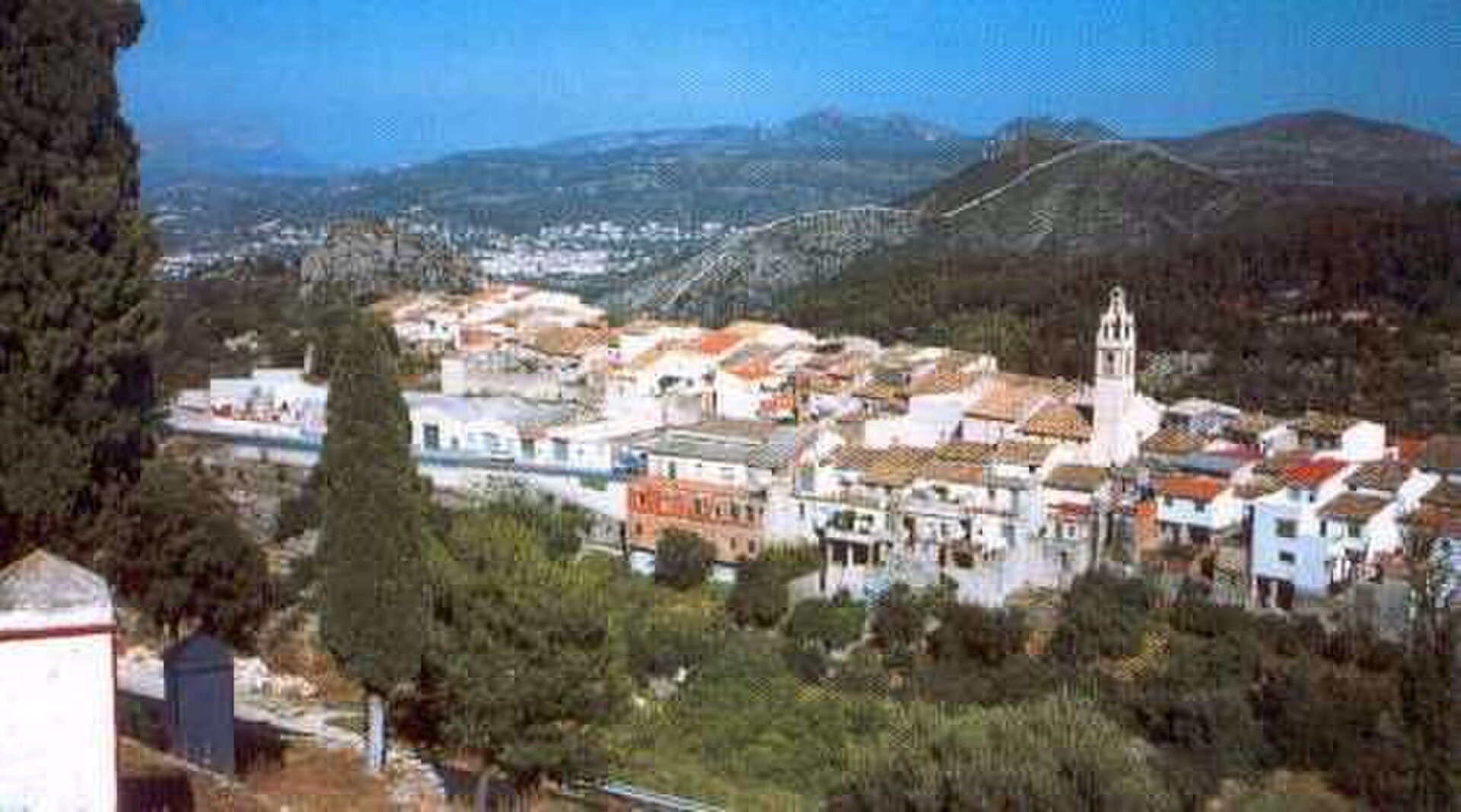
Nestled within the stunning Sierra del Penyó near Alicante, La Vall de Laguar offers a tranquil escape into rural Spain. With an elevation of 450 meters, this municipality provides breathtaking panoramic views and a peaceful environment. Despite its remote feel, it remains accessible, located just 65.5 km from the Alicante-Elche Airport.

905
Population
3734
Sunshine hours/year
299m
Elevation
30
AQI (Fair)

Living & Lifestyle

La Vall de Laguar is defined by its dramatic landscapes and traditional Spanish charm. With a small population of 905 residents spread over an area of 23.0 square kilometers, the community is tight-knit and peaceful. Daily life here revolves around the outdoors and the preservation of local heritage. While amenities are limited, featuring one local restaurant and one pharmacy, the town offers a respite from the hustle of coastal tourism. The area is known for the famous 'Ruta de los Cavalls del Vapor' (Horses of the Steam Route), a historic trail that connects the valley's villages. The air quality is notably good (AQI 30), and the region enjoys 32 local holidays and festivals in 2026, reflecting a rich cultural calendar.
Cavall blanc, la Vall de Laguar.

Climate & Weather

The valley enjoys a Mediterranean climate characterized by abundant sunshine and moderate temperatures. Historical data indicates an impressive 3,734 hours of sunshine annually, providing plenty of bright days for outdoor activities. Rainfall is relatively infrequent, averaging about 83 rainy days per year, which helps maintain the dry, rugged terrain of the surrounding mountains. The elevation of 450 meters ensures cooler evenings compared to the immediate coast, making for comfortable sleeping conditions throughout much of the summer.
Month °C gem. °C max°C min Rainfall mm Sun hours
January 10.6° 14.8°7.2° 72 mm 252h
February 11.6° 16.0°7.9° 33 mm 245h
March 13.0° 17.2°9.3° 136 mm 279h
April 14.9° 19.2°10.9° 94 mm 308h
May 18.7° 23.1°14.3° 45 mm 381h
June 23.4° 28.0°18.6° 25 mm 396h
July 26.3° 31.2°21.4° 15 mm 416h
August 26.3° 31.2°21.7° 32 mm 379h
September 22.3° 26.7°18.7° 99 mm 310h
October 18.8° 23.2°15.3° 65 mm 283h
November 14.1° 18.2°10.9° 53 mm 246h
December 11.9° 15.9°8.7° 65 mm 239h
Barranc del Infern (Conj 1 Abrigo I)

Getting Around

While La Vall de Laguar feels secluded, it is reasonably connected to major transport hubs. The closest international gateway is Alicante-Elche Airport (ALC), located approximately 65.5 km away, which is the primary entry point for most visitors. Valencia Airport (VLC) is further away at 87.6 km. Public transport within the valley is limited, with data indicating no active bus lines but 4 designated stops, suggesting a reliance on private transportation or taxis for travel to the coast and larger towns like Dénia or Gandia.
Photo of La Vall De Laguar

Alicante-Elche (ALC)

65.5 km

Valencia (VLC)

87.6 km

Malaga-Costa del Sol (AGP)

450.0 km

Lines

0

Stops

4

Cycling: - (gradient 0%)

EV Charging Points

  • Iberdrola (8.7 km)

Nature & Beaches

Nature is the true asset of La Vall de Laguar. The municipality is situated within the Sierra del Penyó and the Sierra de la Cavall Verd, featuring dramatic limestone ridges and lush riverbeds (ramblas). While the town itself is inland, the famous beaches of the Costa Blanca are within reach, including the rocky coves of Cala (near Dénia) and the long sandy stretches of Gandia. The valley is a protected area, offering a pristine environment for observing Mediterranean flora and fauna, far removed from the development seen on the coastline.

Sports & Recreation

Outdoor enthusiasts will find La Vall de Laguar to be a hidden paradise, renowned primarily for hiking and mountain biking. The area's main attraction is the 'Cavalls del Vapor' route, a network of trails that wind through the mountains and offer challenging climbs and spectacular views. The terrain is rugged, requiring a good level of fitness to explore the valley's unique geography. Given the elevation and gradient, it is a favored spot for active tourists rather than those seeking sedentary leisure. The altitude and clear air also make it an excellent location for nature photography and birdwatching.

Amenities

Restaurant

1

Pharmacy

1

Air Quality

PM2.5

0.9

µg/m³

PM10

2.1

µg/m³

NO²

0.6

µg/m³

Ozone

76.0

µg/m³

UV Index

0.8

Education

Educational facilities within the immediate municipality are limited due to its small population size. Families with children often rely on local public primary education provided in nearby villages within the valley, while secondary education typically requires commuting to larger towns in the Marina Alta region. There are no international schools directly in La Vall de Laguar, so expatriates usually look towards the coast, between Dénia and Xàbia, for private international schooling options.

Economy & Income

The local economy is historically rooted in agriculture, specifically the cultivation of olives, almonds, and cherries, adapted to the terraced landscape of the valley. Recently, there has been a shift towards rural tourism, with visitors seeking authentic 'eco-tourism' experiences and hiking holidays. The real estate market currently shows limited supply but high value, reflecting a niche market for country homes. With a median property price of €500,000, the area attracts buyers looking for investment properties or exclusive second homes rather than budget relocation.

Net income/person

€12.313

2023

Net/household

€31.507

Median income

€15.750

Gross/person

€14.770

Local Holidays (32)

2026-01-01

Año Nuevo

2026-01-06

Día de Reyes / Epifanía del Señor

2026-02-28

Día de Andalucía

2026-03-01

Dia de les Illes Balears

2026-04-02

Jueves Santo

2026-04-03

Viernes Santo

At a Glance

  • Small, peaceful municipality with a population of 905 residents
  • Located at an elevation of 450 meters in the mountains
  • Annual average of 3,734 hours of sunshine and 83 rain days
  • Located 65.5 km from Alicante-Elche Airport (ALC)
  • Famous for the 'Cavalls del Vapor' hiking route
  • Excellent air quality with an AQI of 30
  • Current market features limited inventory with prices around €500,000

Neighbourhoods

Browse by Property Type

Available Properties

The housing market in La Vall de Laguar is highly exclusive and inventory is currently extremely low. Data shows only one property available for purchase at the moment, priced at €500,000, listed as a new development. This scarcity suggests a market that is stable and in demand for those seeking privacy and specific country characteristics. The housing stock primarily consists of traditional village houses and renovated 'fincas' (farmhouses), offering substantial character and land compared to coastal apartments.
New Build (1) New Build (1)
Bekijk alle woningen in La Vall De Laguar →

Frequently Asked Questions

How far is La Vall de Laguar from the beach?
The town is located inland in the mountains. The nearest beaches are in Dénia, approximately a 25-30 minute drive away.
Is the town walkable and suitable for daily life without a car?
Due to the mountainous terrain and limited local amenities (one restaurant, one pharmacy), a car is highly recommended for daily living and shopping.
What is the primary activity in the area?
The area is best known for hiking and nature, specifically the 'Cavalls del Vapor' trail network that runs through the valley.
What is the real estate market like?
The market is currently very tight with low inventory. Properties are typically high-value traditional homes or new developments, averaging around €500,000.
Are there international schools nearby?
There are no international schools within the immediate valley. The closest options are located in the larger coastal towns like Dénia or Xàbia.
Which airport should I fly into?
Alicante-Elche Airport (ALC) is the closest, situated 65.5 km away. Valencia Airport is a viable alternative at 87.6 km.